系统要求
| 最低内存 |
1024 MB |
| 最小硬盘空间 |
2048 MB |
010-11286-00, DVD
Venture On
Italy TrekMap: Toscana has the same great features as the Land Navigator Italy products plus the added benefit of trails, outdoor points and cycle trails collected from the Regional Environment and Tourism Agencies. Whether you're traveling by foot or by bike, you can easily find your destination using the extensive points of interest database combined with the turn-by-turn outdoor navigation. Italy TrekMap: Toscana contains a preloaded microSD/SD card with complete regional coverage for easy plug & play use in compatible Garmin devices.
Italy TrekMap: Toscana is intended for use in Europe. All content and map data is available in Italian.
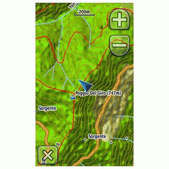
- Provides vector topographic map detail comparable to 1:50,000 and 1:100,000 scale depending on region.
- Includes new SAR-derived DEM for shaded relief display.
- Contains 3-D data for MapSource and compatible Garmin devices.
- Provides regional coverage with a 5 km buffer over the borderline.
- Provides turn-by-turn pedestrian and bike navigation on street network and trails (not for automotive use).
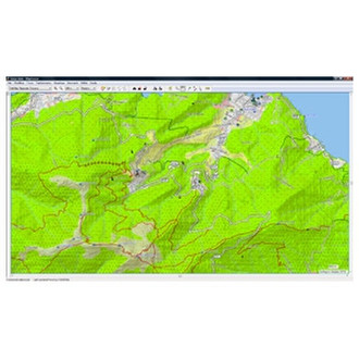
- Includes land use such as woods, urban, crop, beaches, rocks, pastures and more.
- Displays contour lines with a 20 mt interval that better define hill slopes for trekking and mountain biking use.
- Includes glaciers with contour lines.
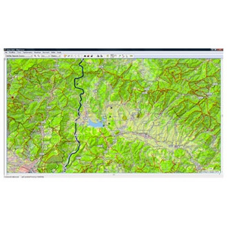
- Contains detailed coastline and hydrographic information for many rivers and lakes.
- Includes about 200 minor natural reserves and regional parks, 1,700 caves by the Italian Speleological Federation, and National and Natural Park and Reserve boundaries.
- Transfer waypoints, routes and tracks between your compatible Garmin device and your PC with the MapSource trip and waypoint management functions.
- Contains 7,000 km of footpaths, surveyed by professionals.
- Includes 2,100 water sources and fountains.
- Includes about 7,400 crosses, chapels and landmarks.