技术细节
| 峰值功率 |
4000 W |
| 最大深度 |
579 m |
| 频率 |
50/77/200 kHz |
| 水温传感器 |
Y |
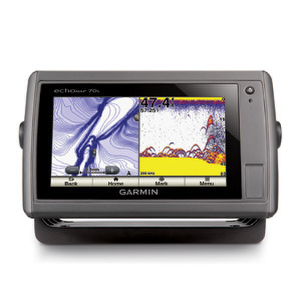
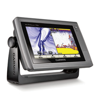
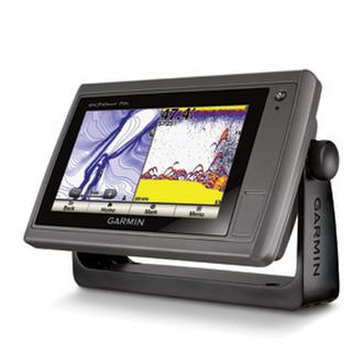
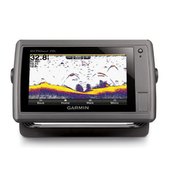
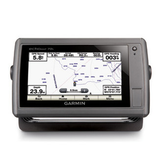
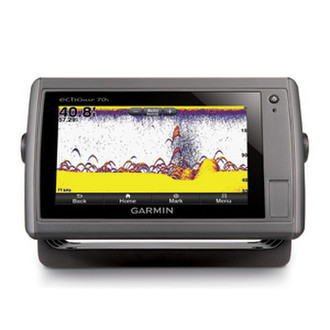
echoMAP 70s with Transom Motor Mount Transducer, Worldwide Basemap and US Lakes Charts - 50/77/200kHz, 500W(RMS)/4000W(peak to peak), 10-32Vdc, 1900ft
echoMAP 70s is an amazing chartplotter and fishfinder combination, featuring a 7" WVGA touchscreen display with pinch-to-zoom, and it comes with a worldwide basemap or U.S. LakeVü™ HD or BlueChart® g2 offshore cartography for the coastal U.S.
The crystal-clear display provides clear target separation, allows visibility both day and night, and has a user interface that anyone can navigate. Plus, it has multi-touch functions and auto-dimming to enhance your screen views.
<b>Super-fast 10 Hz GPS/GLONASS</b>
With the integration of a 10Hz GPS/GLONASS receiver, the 70s refreshes position and heading up to 10 times per second. It displays constant and fluid on-screen location and proves to be incredibly accurate when marking waypoints and navigating.
<b>Advanced Sonar Support</b>
Built-in support for a wide selection of Garmin transducers, including 50/200 kHz, 77/200 kHz, DownVü™ and SideVü™ scanning sonar, and CHIRP. In addition, it will also support Minn Kota® and MotorGuide® trolling motor transducers.
<b>Add the Clearest Images on the Water</b>
Add the optional GCV™ 10 black box sonar to enjoy Garmin DownVü and SideVü scanning sonar with the clearest scanning sonar images on the water.
<b>Networking</b>
The echoMAP 70s offers select networking capabilities that allow you to share features with other compatible GPSMAP units, such as DownVü and SideVü scanning sonar, supplemental maps, and user data, including waypoints, routes and tracks. User data entered into 1 chartplotter can be automatically synced with other chartplotters in a network.
<b>Sonar Recording</b>
The echoMAP 70s also includes sonar-recording capability that coordinates the timing of the sonar return with your boat's position and saves digital information for playback on a computer using HomePort™ planning software.
<b>Get Your iPad® On Board</b>
Plan and view routes on your iPad, iPhone® or iPod® with BlueChart® Mobile. Easily and wirelessly transfer those routes to your networked chartplotter with built-in Wi-Fi® capability.
Available with preloaded LakeVü HD maps — more than 17,000 lakes plus more than 5,700 HD lakes with 1’ contours shoreline to shoreline — or BlueChart g2 coastal maps.