内存参数
| 航点 |
Y |
| 轨道数量 |
200 |
| 航线数量 |
200 |
| 内置存储器容量 |
3.7 GB |
| 内置存储器 |
Y |
| 兼容性内存条 |
MicroSD (TransFlash) |
| 存储卡插槽(S) |
Y |
显示器
| 显示器尺寸 |
2.2 " |
| 显示技术 |
TFT |
| 屏幕尺寸 |
44 x 35 mm |
| 内置显示器 |
Y |
技术细节
| 气压高度表 |
Y |
| 电子罗盘 |
Y |
| 图片查看器 |
Y |
| 日月相功能 |
Y |
| 潮汐表 |
Y |
| 单位对单位转让 |
Y |
| 基本图 |
Y |
| 附加地图功能 |
Y |
| 保护功能 |
Water resistant |
| 内置摄像头 |
N |
| 国际保护(IP)代码 |
IPX7 |
| 主要应用 |
Personal |
电池
| 电池类型 |
Replaceable |
| 电池寿命(最大值) |
25 h |
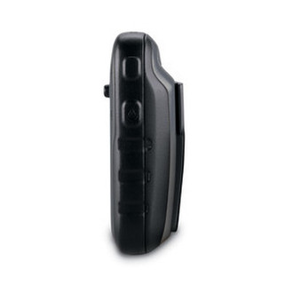
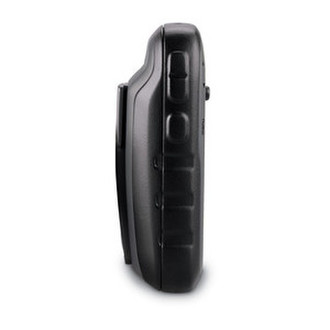
重量和尺寸
| 深度 |
33 mm |
| 宽度 |
54 mm |
| 重量 |
141.7 g |
| 高度 |
103 mm |
另外
| 显示器的颜色数量 |
65536 colours |
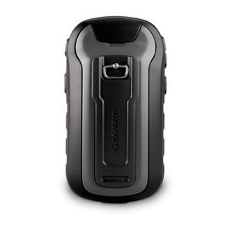
| 产品色彩 |
Black |
| 导航点/喜爱点数量 |
2000 |
5.588 cm (2.2 ") , 240 x 320 px, 3.7 GB, microSD
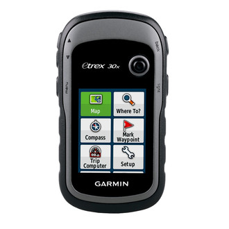
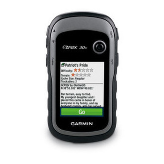
Handheld GPS with 3-axis Compass, Enhanced Display and Preloaded Mapping
-2.2 inch crystal clear colour display
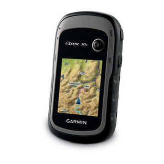
-Preloaded Western Europe Garmin TopoActive map with shaded relief
-High-sensitivity, GPS receiver with HotFix® and GLONASS support
-4GB internal memory. Expand further with a microSD™ card (not included).
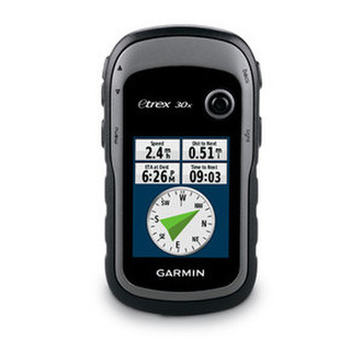
-3-axis compass and barometric altimeter
-Worldwide basemap with shaded relief
eTrex 30x is our upgraded version of the popular eTrex 30, with enhanced screen resolution and extended internal memory to hold more maps. The preloaded Garmin TopoActive supports and enhances a range of outdoor activities, such as hiking, geocaching, cycling, mountaineering and fishing. eTrex 30x has superior features compared to eTrex 30, while maintaining its ease-of-use, affordability and legendary durability.
See the Way
eTrex 30x has an enhanced 2.2 inch, 65K colour, sunlight-readable display. Durable and water-resistant, eTrex 30x is built to withstand the elements. It has an upgraded interface yet retains its toughness to withstand dust, dirt, humidity or water.
New Tools for Your Trek
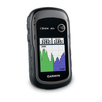
The new in-built 3-axis tilt-compensated electronic compass keeps your bearings even when you’re standing still or not holding it level. Also added is a barometric altimeter that tracks changes in pressure to pinpoint your altitude. Use it to plot barometric pressure over time to help you keep an eye on changing weather conditions.
Go Anywhere
Fit your eTrex 30x just about anywhere, using an array of compatible mounts. Use the auto mount capability and City Navigator NT maps for turn-by-turn driving directions, or the rugged mount for your bike or quad. You can even mount to a boat for fishing or sailing trips.
Go Global
The eTrex series can track both GPS and GLONASS satellites simultaneously – it has the ability to lock on to 24 more satellites than using just GPS. What’s more, the time it takes to “lock on” to a position is (on average) 20% faster than using GPS alone. With its high-sensitivity EGNOS-enabled GPS receiver and HotFix satellite prediction, eTrex locates your position quickly and precisely and maintains its GPS location even in heavy cover and deep valleys.
Preloaded Garmin TopoActive Map
eTrex 30x comes preloaded with the new Garmin TopoActive map of Western Europe, a perfect starting point for your first recreational activity with GPS. The map provides relevant useful information for activities like hiking and cycling, it's routable and shows elevation changes. Garmin TopoActive map of Western Europe covers the following countries: Albania, Andorra, Austria, Belgium, Denmark, Finland, France, Germany, Iceland, Ireland, Italy, Liechtenstein, Luxembourg, Malta, Monaco, Netherlands, Norway, Portugal, San Marino, Spain, Sweden, Switzerland, United Kingdom and the Vatican City.
Use the microSD card slot to load additional advanced maps – like Topo maps, BlueChart g2 marine maps or City Navigator NT maps. eTrex 30x also supports BirdsEye Satellite Imagery (subscription required) to download and integrate with your maps.
Share Wirelessly
eTrex 30x lets you share your routes, geocaches and other user data wirelessly with other compatible devices. Simply press “send” to transfer your information and share your adventure with friends.
eTrex also connects to compatible Garmin devices, including VIRB and accessory sensors, including tempe, foot pod and heart rate monitor.
Keep Your Fix
With its high-sensitivity, EGNOS-enabled GPS receiver and HotFix satellite prediction, eTrex locates your position quickly and precisely and maintains its GPS location even in heavy cover and deep valleys.
Find Fun
eTrex 30x supports paperless geocaching GPX files for endless geocaching adventures. Just visit Take control of your next adventure with BaseCamp. The free, trip-planning software allows you to view and organise maps, routes and more, and even create Garmin Adventures to share with friends, family or fellow explorers. BaseCamp displays topographic map data in 2D or 3D on your computer screen, as well as a vast array of satellite images when paired with a BirdsEye Satellite Imagery subscription.