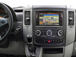
GPS类型
| 自动 |
N |
| 体育(健身,跑 步,骑自行车) |
N |
| 户外(登山,远足) |
N |
| 海洋(图绘图仪,探测器,测距仪鱼) |
Y |
| 地理寻宝 (gps寻宝) |
N |
| 航空 |
N |
其他功能
| 基本图 |
Y |
| 接口 |
NMEA 0183, NMEA 2000 |
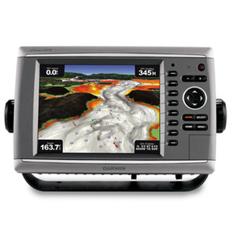
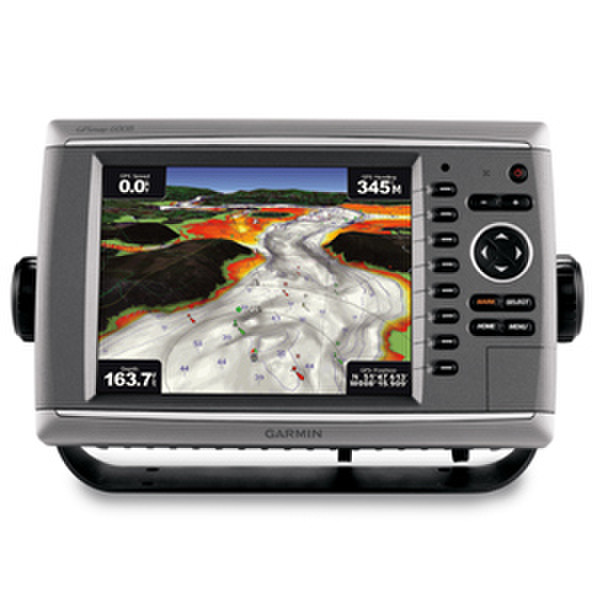
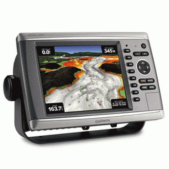
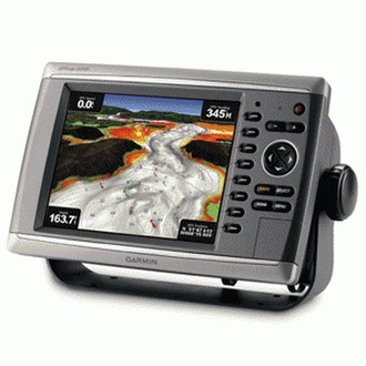
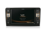
GPSMAP 6008 - 8.4", 640 x 480, VGA, NMEA 0183, NMEA 2000, SD
Unleash a new level of power across your helm with the GPSMAP 6008. This premier chartplotter is the next evolution in Garmin’s series of full-featured marine products. The GPSMAP 6008 comes standard with a worldwide, satellite-enhanced basemap as well as video-quality resolution on an 8.4” VGA display. The GPSMAP 6008 also provides total system integration – allowing support for the addition of sonar, radar, weather and more. For additional enhanced features, you can add the optional BlueChart® g2 Vision® card.
Designed to Move
The GPSMAP 6008 brings unprecedented speed to your vessel with Garmin G MotionTM technology – the future of marine technology today. With blazing-fast map redraw and refresh rates, you’ll have near real-time data to guide you. Whether you’re in a crowded harbor or in uncertain weather, you’ll have the confidence you need to navigate your surroundings with the GPSMAP 6008 as your guide. The GPSMAP 6008 is also compatible with an optional remote for added flexibility. And with a sleek and stylish design that was built to brave the elements, the GPSMAP 6008 looks great in any helm.
View Detailed Graphics and Video
The GPSMAP 6008 features a worldwide basemap with high-quality satellite images in place of more traditional maps. And for more detail, you can easily add maps with the SD™ card slot without having to connect to a computer. The GPSMAP 6008’s high-speed processor draws maps quickly, and its simple intuitive interface makes navigating easy. To keep tabs on your engine room or other area of your boat, you can also connect a live video feed with the GPSMAP 6008’s video input and output options. The GPSMAP 6008 also comes standard with a wide range of brightness options - from sunlight-readable to low-light conditions, you can adjust the setting to match the your surroundings.
Add Extras with BlueChart g2 Vision
With the optional BlueChart g2 Vision SD card, you can add a whole new dimension of exceptional features to your chartplotter.
- MarinerEye view and FishEye view provide you a 3-dimensional perspective of map information, both above and below the waterline.
- High-resolution satellite images and aerial photographs help you orient yourself in unfamiliar areas.
- Auto Guidance technology searches through all relevant charts to create a route you can actually follow — one that avoids obstacles, shallow water, buoys and other obstructions.
Connect to your network
The GPSMAP 6008 easily connects to your network - providing system integration so you can interface with additional MFDs and add remote sensors. Once connected, you can share information between the GPSMAP 6008 and other chartplotters on your boat. You can also add high-powered radar, sonar and XM satellite weather and radio to your system.