能量控制
| 支持的的电池数量 |
2 |
| 电池类型 |
AA |
| 电池寿命(最大值) |
16 h |
技术细节
| 打猎/鱼日历 |
Y |
| 图片浏览器 |
Y |
| 单位对单位转让 |
Y |
| 潮汐表 |
Y |
| 面积的计算方法 |
Y |
| 日月相功能 |
Y |
| 航点 |
Y |
GPS类型
| 自行车 |
Y |
| 露营/营地 |
Y |
| 高尔夫球 |
Y |
| 卡车 |
Y |
| 摩托车 |
Y |
| 户外(登山,远足) |
Y |
| 地理寻宝 (gps寻宝) |
Y |
| 自动 |
Y |
导航
| 兴趣点 |
10000 |
| 自动路由 |
Y |
| 气压高度表 |
Y |
| 电子罗盘 |
Y |
| 航线数量 |
200 |
| 轨道数量 |
200 |
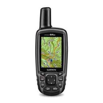
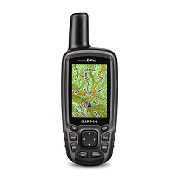
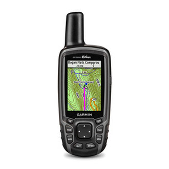
6.604 cm (2.6 ") 65-K color TFT, IPX7, 8GB, microSD, 8.1 oz
<b>Rugged, Full-featured Handheld with GPS, GLONASS and Wireless Connectivity</b>
- 2.6" sunlight-readable color screen
- High-sensitivity GPS and GLONASS receiver with quad helix antenna
- Preloaded TOPO Canada maps plus a 1-year BirdsEye Satellite Imagery subscription
- 3-axis compass with barometric altimeter
- Wireless connectivity via Bluetooth® Smart technology or ANT+
GPSMAP 64st features a 2.6” sunlight-readable color screen and a high-sensitivity GPS and GLONASS receiver with a quad helix antenna for superior reception. GPSMAP 64st includes a 3-axis electronic compass with barometric altimeter, wireless connectivity, and preloaded TOPO Canada maps plus a 1-year BirdsEye Satellite Imagery subscription.
<b>Explore the Terrain</b>
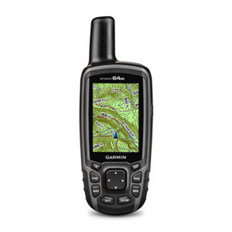
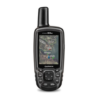
GPSMAP 64st comes with a worldwide basemap with shaded relief and is preloaded with TOPO Canada. Plus it includes a 1-year BirdsEye Satellite Imagery subscription — all the tools for serious climbing or hiking. Map detail includes national, state and local parks and forests, along with terrain contours, elevation information, trails, rivers, lakes and points of interest.
<b>Get Your Bearings</b>
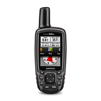
GPSMAP 64st has a built-in 3-axis tilt-compensated electronic compass, which shows your heading even when you’re standing still, without holding it level. Its barometric altimeter tracks changes in pressure to pinpoint your precise altitude, and you can even use it to plot barometric pressure over time, which can help you keep an eye on changing weather conditions.
<b>Share Wirelessly</b>
Share your waypoints, tracks, routes and geocaches wirelessly with other compatible devices. Your friends can enjoy your favorite hike or cache without waiting for you to plug in to your computer — simply press “send” to transfer your information via ANT+ or your Bluetooth Smart Ready phone¹.
<b>Stay Connected</b>
With Smart Notification you can wirelessly receive email, texts and alerts from your compatible iPhone® 4s or later. Stay connected without having to dig into your backpack for your smartphone.
<b>Keep Your Fix</b>
With its quad helix antenna and high-sensitivity, GPS and GLONASS, receiver, GPSMAP 64st locates your position quickly and precisely and maintains its location even in heavy cover and deep canyons. The advantage is clear — whether you’re in deep woods or just near tall buildings and trees, you can count on GPSMAP 64st to help you find your way when you need it the most.
<b>Add Maps</b>
GPSMAP 64st comes with a built-in worldwide basemap with shaded relief, preloaded TOPO Canada and a 1-year subscription of BirdsEye Satellite Imagery for a photo-realistic view. Adding more maps is easy with our array of detailed topographic, marine and road maps. With 8 GB of onboard memory and microSD™ card slot, you can conveniently download TOPO 24K maps and hit the trail, plug in BlueChart® g2 preloaded cards for a great day on the water or City Navigator NT® map data for turn-by-turn routing on roads (see maps tab for compatibility). In addition, the 64st is compatible with Garmin Custom Maps, free software that transforms paper and electronic maps into downloadable maps for your device.
<b>Find Fun</b>
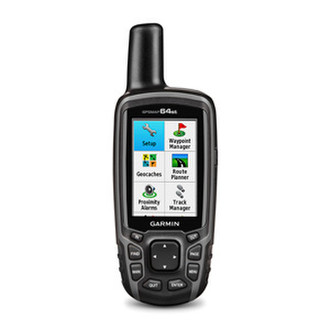
GPSMAP 64st supports paperless geocaching with 250,000 preloaded caches with hints and descriptions from Geocaching.com², and has a 16-hour rechargeable NiMH battery. By going paperless, you're not only helping the environment, but also improving efficiency. GPSMAP 64st stores and displays key information, including location, terrain, difficulty, hints and descriptions, which means there’s no more manually entering coordinates and paper printouts! Slim and lightweight, 64st is the perfect companion for all your outdoor pursuits.
<b>Plan Your Next Trip</b>
Take charge of your next adventure with BaseCamp™, software that lets you view and organize maps, waypoints, routes and tracks. This free trip-planning software even allows you to create Garmin Adventures that you can share with friends, family or fellow explorers. BaseCamp displays topographic map data in 2-D or 3-D on your computer screen, including contour lines and elevation profiles. It also can transfer an unlimited amount of satellite images to your device when paired with a BirdsEye Satellite Imagery subscription.