能量控制
| 支持的的电池数量 |
2 |
| 电池类型 |
AA |
| 电池寿命(最大值) |
16 h |
技术细节
| 打猎/鱼日历 |
Y |
| 图片浏览器 |
Y |
| 追踪记录 |
Y |
| 单位对单位转让 |
Y |
| 潮汐表 |
Y |
| 面积的计算方法 |
Y |
| 日月相功能 |
Y |
| 航点 |
Y |
导航
| 在线服务 |
N |
| 照片导航 |
Y |
| 导航协议 |
NMEA 0183 |
| 自动路由 |
Y |
| 气压高度表 |
Y |
| 电子罗盘 |
Y |
| 航线数量 |
200 |
| 交通信息频道(TMC) |
N |
GPS类型
| 高尔夫球 |
N |
| 卡车 |
N |
| 自动 |
N |
| 户外(登山,远足) |
Y |
| 地理寻宝 (gps寻宝) |
Y |
| 海洋(图绘图仪,探测器,测距仪鱼) |
N |
| 体育(健身,跑 步,骑自行车) |
N |
| 航空 |
N |
另外
| 包括 AC 适配器 |
Y |
| 导航点/喜爱点数量 |
2000 |
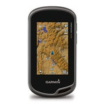
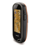
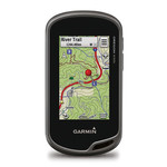
7.62 cm (3 ") TFT, 240 x 400, 2 x AA NiMH, IPX7, USB & NMEA 0183, 850MB, microSD, Camera 3.2MP + TrekMap ITA v3 PRO
The navigator with the photographic memory! Oregon 550 combines rugged outdoor touchscreen navigation with a digital camera. It is perfect for all activities, in any climate, on any terrain, yet simple enough for beginners to master.
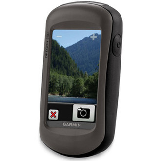
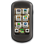
<b>Take Pictures and Save Locations</b>
Oregon 550's 3.2 megapixel autofocus digital camera with 4x digital zoom automatically. geotags each photo with the location of where it was taken, allowing you to mark, remember and navigate back to that exact spot in the future. You can take and view pictures in landscape or portrait, and 850 MB of internal memory offers ample storage. Connect Oregon 550 via USB and log into my.Garmin.com to upload and store your photos at Picasa™, a popular online photo sharing community.
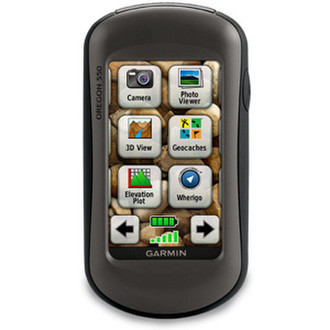
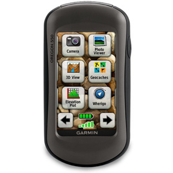
<b>Touch and Go</b>
Oregon 550 has a tough, 7.62 cm (3 in) diagonal, sunlight-readable, colour touchscreen display with a simple-to-use menu system. Both durable and waterproof, Oregon 550 is built to withstand the elements.
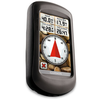
<b>Get Your Bearings</b>
Oregon 550 has a built-in 3-axis tilt-compensated electronic compass, which shows where you're heading even when you’re standing still, without holding it level. Its barometric altimeter tracks changes in pressure to pinpoint your precise altitude.
With high-sensitivity, WAAS-enabled GPS receiver and HotFix® satellite prediction, Oregon 550 locates your position quickly and precisely and maintains its GPS location even in heavy cover and urban landscapes.
<b>Add Maps</b>
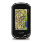
Oregon 550 comes preloaded with a worldwide built-in basemap with shaded relief. You can add maps for walking, driving and for use out on the water.
On the trail a TOPO GB DVD or Garmin GB Discoverer™ microSD™ card gives topographic and Ordnance Survey map detail, showing terrain contours, summits, trails and more.
On the road you can add Garmin GB Discoverer or City Navigator® mapping for detailed street maps and turn-by-turn directions to your destination.
On the water you can add BlueChart® g2 maps which provide information such as depth contours, full charting and harbours.
<b>Go Geocaching</b>
Go paperless with Oregon 550 by quickly downloading information from Opencaching.com for up to 5,000 caches, such as location, terrain, difficulty, hints and description.
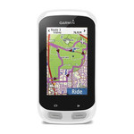
Use for running or cycling
The Oregon is compatible with Garmin’s heart-rate monitors and speed/cadence sensors and can track your speed, distance, elevation and location.
<b>Share Wirelessly</b>
With Oregon 550, you can share your waypoints, tracks, routes and geocaches wirelessly other Oregon and Colorado® users. Now you can send your favorite route to a friend to enjoy or the location of a cache to find. Sharing data is easy. Just touch "send" to transfer your information to similar devices.