能量控制
| 支持的的电池数量 |
1 |
| 电池寿命(最大值) |
16 h |
技术细节
| 打猎/鱼日历 |
Y |
| 图片浏览器 |
Y |
| 单位对单位转让 |
Y |
| 潮汐表 |
Y |
| 面积的计算方法 |
Y |
| 日月相功能 |
Y |
| 航点 |
Y |
GPS类型
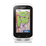
| 自行车 |
Y |
| 露营/营地 |
Y |
| 高尔夫球 |
Y |
| 卡车 |
Y |
| 摩托车 |
Y |
| 自动 |
Y |
| 户外(登山,远足) |
Y |
| 地理寻宝 (gps寻宝) |
Y |
导航
| 兴趣点 |
10000 |
| 自动路由 |
Y |
| 气压高度表 |
Y |
| 电子罗盘 |
Y |
| 航线数量 |
200 |
| 轨道数量 |
200 |
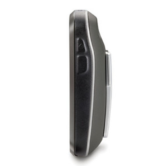
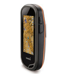
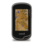
7.62 cm (3 ") Transflective color TFT Touchscreen, IPX7, USB, 8MP Camera, 1.75 GB, microSD, 7.4 oz
<b>More Features, More Satellite Power</b>
- 3-inch sunlight-readable touchscreen display with dual orientation
- Preloaded TOPO U.S. 100K maps with shaded relief basemap
- 8 megapixel autofocus, digital zoom camera with flash/torch
- 3-axis compass with accelerometer and barometric altimeter sensors
- Dual battery — 2 AA batteries or included rechargeable internal NiMH pack
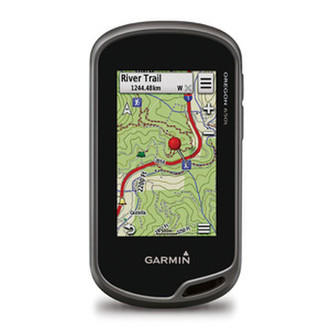
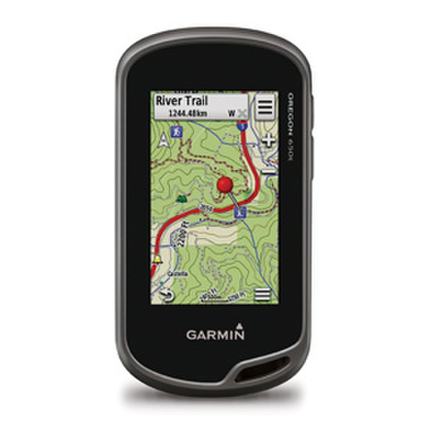
With high-sensitivity GPS and GLONASS satellite tracking, preloaded TOPO U.S. 100K maps, worldwide basemap with shaded relief, and customizable buttons for 1-touch image capture and waypoint marking, Oregon 650t opens a new world of GPS mapping and positioning.
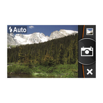
<b>Quality Photos</b>
Take quality photos with Oregon 650t's built-in 8 megapixel autofocus digital camera. Each photo is geotagged, allowing you to navigate back to that exact spot. Share the photos with all your friends through Garmin Adventures. For more storage, insert a microSD™ card. You can even view pictures from other devices on microSD card with Oregon’s picture viewer.
<b>Touch and Go</b>
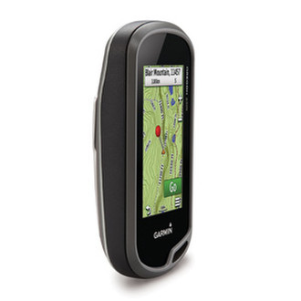
Oregon 650t has reflective display technology for the most brilliant, sunlight readable touchscreen we’ve ever made. The screen is strengthened for impact resistance, with multi-touch and dual orientation views that accommodate gloved operation.
<b>Double Your Power</b>
Oregon 650t features our state-of-the-art dual battery system. You’ll have the option of using the internally rechargeable NiMH pack (included) or traditional AA batteries — NiMH pack charges when the device is connected to external power.
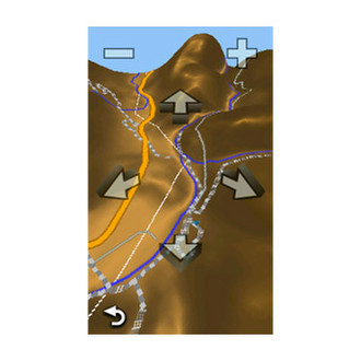
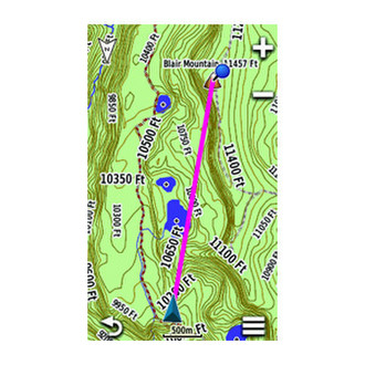
<b>Explore the Terrain</b>
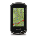
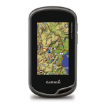
Oregon 650t comes with built-in US topographic data for the entire US, including Alaska, Hawaii and Puerto Rico, and a worldwide basemap with shaded relief — all the tools for serious climbing or hiking. Map detail includes national, state and local parks and forests, along with terrain contours, elevation information, trails, rivers, lakes and points of interest.
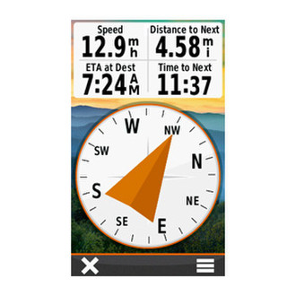
<b>Get Your Bearings</b>
Oregon 650t has a built-in 3-axis electronic compass with accelerometer tilt compensation to show where you're heading even when standing still, or not holding it level. Its barometric altimeter tracks changes in pressure to pinpoint your precise altitude. You can even use it to plot barometric pressure over time to keep an eye on changing weather conditions.
With its high-sensitivity, WAAS- and GLONASS-enabled GPS receiver and HotFix® satellite prediction, Oregon 650t locates your position quickly and precisely, and maintains its GPS location even in heavy cover and deep canyons.
<b>Share Wirelessly</b>
With Oregon 650t you can share your waypoints, tracks, routes and geocaches up to 50 times faster with other wireless compatible Garmin handheld devices. Plus, you can share large files too like photos, Garmin Adventures and Custom Maps. Just touch “send” to transfer your information.
<b>Add Maps</b>
Adding more maps to Oregon is easy. Load TOPO U.S. 24K maps and hit the trail; add Trailhead Series TOPO maps and explore famous treks like the Appalachian Trail and the Pacific Crest Trail; plug in BlueChart® g2 preloaded cards for a great day on the water; or load City Navigator® map data for turn-by-turn routing on roads. Add satellite images to your maps with BirdsEye Satellite Imagery (subscription required).
<b>Load All the Geocaches</b>
No more picking, choosing and planning, just download them all. Oregon 650t can hold up to 4 million. Download every cache on Geocaching.com. Load caches using your favorite program or website that supports GGZ files. All your paperless geocaching features will be there for every cache. Read full descriptions, hints and logs. Filter caches by size, terrain, difficulty and type. Connect to chirp-enabled caches. Record your logs in the field. Do it all.
<b>Plan Your Next Trip</b>
Take charge of your next adventure with BaseCamp™, software that lets you view and organize maps, waypoints, routes and tracks. This free trip-planning software even allows you to create Garmin Adventures that you can share with friends, family or fellow explorers. BaseCamp displays topographic map data in 2-D or 3-D on your computer screen, including contour lines and elevation profiles. It also can transfer an unlimited amount of satellite images to your device when paired with a BirdsEye Satellite Imagery subscription.