系统要求
| 最低内存 |
1024 MB |
| 最小硬盘空间 |
2048 MB |
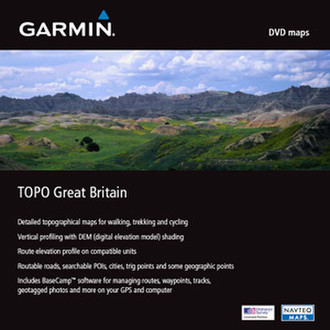
TOPO Great Britain, DVD
Venture On
Trek through the highlands and the lowlands with detailed topographic maps. TOPO Great Britain includes terrain contours, topo elevations, summits, routable roads, paths, parks, coastlines, rivers, lakes and geographical points. These detailed maps are ideal for hiking, hunting, cycling and communing with nature. Coverage includes topographic detail throughout Great Britain. Available on DVD. Topographic data is provided by Ordnance Survey of Great Britain; road maps are provided by NAVTEQ.
- Includes topographic coverage throughout Great Britain.
- Provides detailed digital topographic maps with topographic data from Ordnance Survey® of Great Britain.
- Contains summit locations with elevation, detailed contours, and trig points.
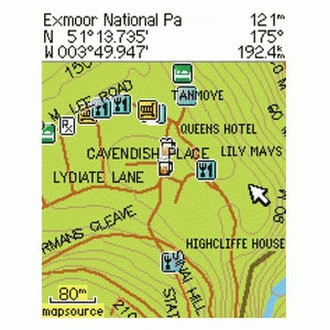
- Allows you to search by city, geographic point, summit, lakes and more.
- Provides elevation profile on compatible Garmin devices so you can estimate terrain difficulty.
- Contains many trails, tracks and paths.
- Includes points of interests such as parks, scenic lookouts and picnic sites as well as lodging, food, petrol stations and hopsitals.
- (DVD/CD-ROM only) Includes MapSource, computer software that lets you plan trips on your computer and transfer waypoints, routes and tracks between your computer and your Garmin device.
Product Restrictions
Certain limitations are placed on Topo Great Britain v2 due to licensing restrictions:
- No printing
- Restricted size of map detail viewing area