能量控制
| 支持的的电池数量 |
2 |
| 电池类型 |
AA |
| 电池寿命(最大值) |
18 h |
GPS类型
| 卡车 |
N |
| 自动 |
Y |
| 户外(登山,远足) |
Y |
| 地理寻宝 (gps寻宝) |
Y |
| 航空 |
N |
GPS性能
| GPRS精度-位置 |
5 m |
| 广域扩充系统能力 |
Y |
| 天线 |
Y |
导航
| 航线数量 |
25 |
| 轨道数量 |
10 |
| 交通信息频道(TMC) |
N |
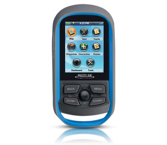
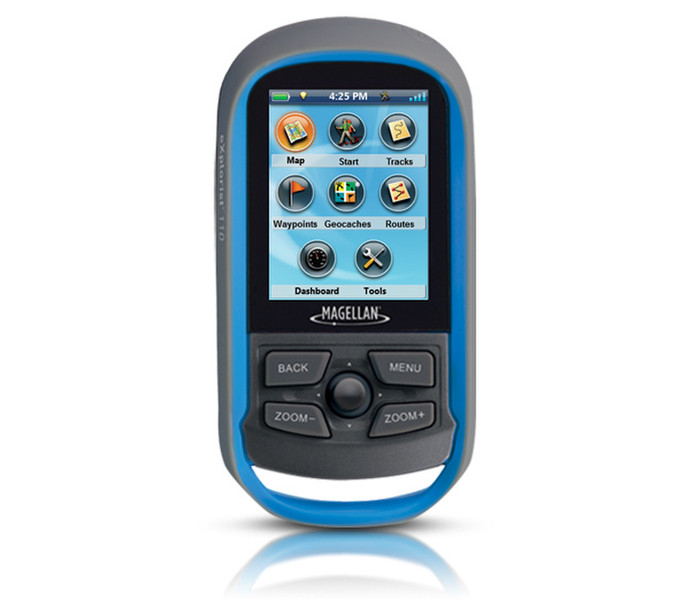
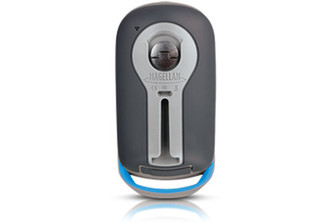
eXplorist 110 NA, 147g, 2 x AA, 2GB, 5.588 cm (2.2 ") , 240 x 320
A vibrant, transflective color screen allows for the best readability in direct sunlight. To zero in on the exact location of a geocache, favorite fishing spot, or the next summit, the SiRFstarIII GPS chipset provides accuracy of 10-15 feet (3-5 meters). To keep your outdoor adventure going all day long, the device is powered by two AA batteries for 18 hours of constant usage. The eXplorist 110 is rugged, waterproof, and submersible (IPX-7). All of this is packed into a small and attractive handheld form factor that can be hung around your neck with the optional Magellan lanyard or attached to your pack with the built-in carabineer hook.
The eXplorist 110 is pre-loaded with the World Edition map, which includes a complete road network in the United States, Canada, Western Europe, and Australia and major roads throughout the rest of the world. This unique map also includes water features, urban and rural land use, and city centers.
With the 110 you can overlay a series of different transparent compass styles on top of the pre-loaded World Map that shows roads, water features, parks, and city centers. The dashboard screen a mini-compass for quick reference and customizable navigation data fields, such as latitude, longitude, heading, bearing, distance to end, trip odometer, and many more. View your active track, which is a series of digital breadcrumbs that records all your movements. Mark your starting point (car, trailhead, parking lot…) with a waypoint and easily navigate back at the end of the day.
Reference your track summary to keep track of your distance travelled, elevation gained or lost, complete travel time, moving time and stopped time, and average time to find. Easily reset your track summary statistics to track the details of your next geocaching adventure.
No matter where you enjoy the outdoors, the eXplorist 110 GPS receiver will provide precise GPS signals thanks to the Satellite Based Augmentation Systems (SBAS) of WAAS, EGNOS, and MSAS; display coordinates in a myriad of different global systems, including UTM and WGS84; and accurately guide you to and from your next adventure, where ever in the world that may be!