能量控制
| 支持的的电池数量 |
2 |
| 电池寿命(最大值) |
18 h |
| 电池类型 |
AA |
技术细节
| 打猎/鱼日历 |
Y |
| 日历 |
Y |
| 日月相功能 |
Y |
| 计算器 |
Y |
| 航点 |
Y |
其他功能
| 天线类型 |
Multidirectional Patch |
导航
| 在线服务 |
Y |
| 航线数量 |
50 |
| 轨道数量 |
50 |
| 交通信息频道(TMC) |
N |
GPS类型
| 自动 |
Y |
| 户外(登山,远足) |
Y |
| 地理寻宝 (gps寻宝) |
Y |
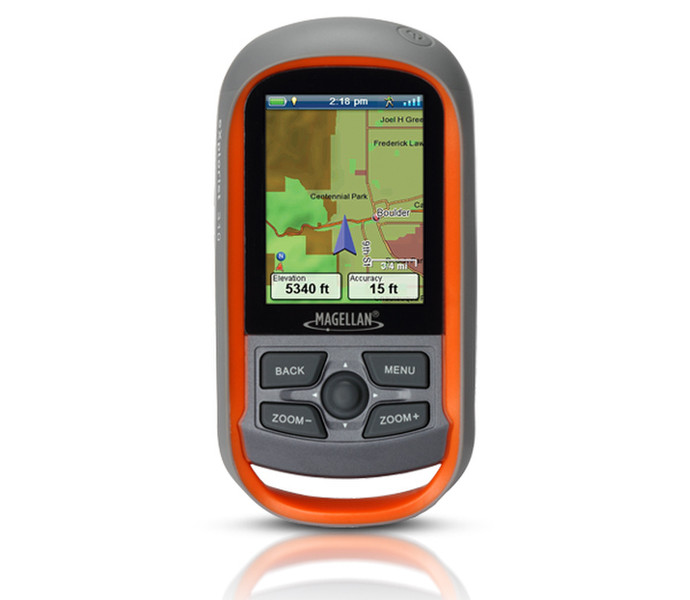
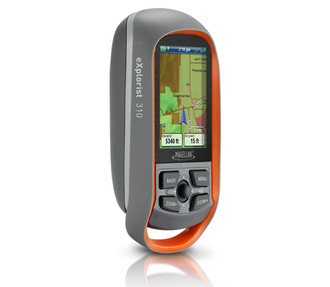
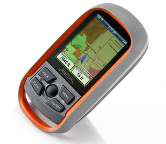
eXplorist 310, 147g, 2 x AA, 400MHz, 2GB, 5.588 cm (2.2 ") , 240 x 320
The Magellan eXplorist 310 GPS receiver comes packed with tons of helpful features and is ready to use right out of the box.
The eXplorist 310 is pre-loaded with the World Edition map, which includes a complete road network in the United States, Canada, Western Europe, and Australia and major roads throughout the rest of the world. This unique preloaded map also includes water features, urban and rural land use, and city centers. Regional versions of Magellan’s Summit Series topographic maps are available for download to expand mapping coverage and level of detail.
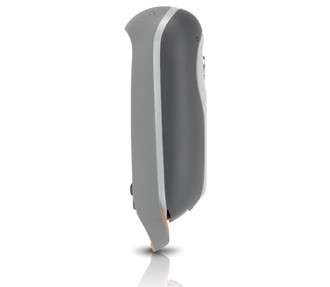
A vibrant, transflective color screen allows for the best readability in direct sunlight. To zero in on the exact location of a geocache, favorite fishing spot, or the next summit, the SiRFstarIII GPS chipset provides accuracy of 10-15 feet (3-5 meters). To keep your outdoor adventure going all day long, the device is powered by two AA batteries for 18 hours of constant usage. The eXplorist 310 is rugged, waterproof, and submersible (IPX-7). All of this is packed into a small and attractive handheld form factor that can be hung around your neck with the optional Magellan lanyard or attached to your pack with the built-in carabineer hook.
The eXplorist 310 provides unmatched assistance with navigation, such as the combination of the world’s two most useful navigational tools – a compass and a map! Overlay a series of different transparent compass styles on top of a pre-loaded worldwide map that show roads, water features, parks, and city centers. Access the dashboard screen that shows a mini-compass for quick reference and customizable navigation data fields, such as latitude, longitude, heading, bearing, distance to end, trip odometer, and many more. Go back to the map screen and view your active track, which is a series of digital breadcrumbs to record all yours movements. Mark your starting point (car, trailhead, parking lot…) with a waypoint and easily navigate back to that location at the end of the day.
The eXplorist 310 supports paperless geocaching, which allows you to download more than 20 unique characteristics of each cache, including name, location, description, hider, size, difficulty, terrain, hint, spoilers, attributes, and last 20 user logs among a number of other details.
Reference your track summary to keep track of your distance travelled, elevation gained or lost, complete travel time, moving time and stopped time, and average time to find. Easily reset your track summary statistics to track the details of your next geocaching adventure.