能量控制
| 支持的的电池数量 |
3 |
| 电池类型 |
AA |
| 电池寿命(最大值) |
16 h |
技术细节
| 打猎/鱼日历 |
Y |
| 图片浏览器 |
Y |
| 追踪记录 |
Y |
| 单位对单位转让 |
Y |
| 潮汐表 |
Y |
| 面积的计算方法 |
Y |
| 日月相功能 |
Y |
| 航点 |
Y |
导航
| 在线服务 |
N |
| 照片导航 |
Y |
| 自动路由 |
Y |
| 气压高度表 |
Y |
| 电子罗盘 |
Y |
| 航线数量 |
200 |
| 轨道数量 |
200 |
| 交通信息频道(TMC) |
N |
GPS类型
| 卡车 |
N |
| 自动 |
N |
| 户外(登山,远足) |
Y |
| 地理寻宝 (gps寻宝) |
Y |
| 海洋(图绘图仪,探测器,测距仪鱼) |
N |
| 体育(健身,跑 步,骑自行车) |
N |
| 航空 |
N |
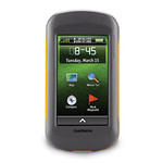
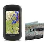
10.16 cm (4 ") TFT, 272 x 480, IPX7, USB & NMEA 0183, 3.0GB, microSD, Camera 5MP + City Navigator Europe
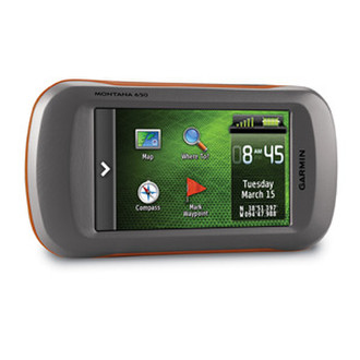
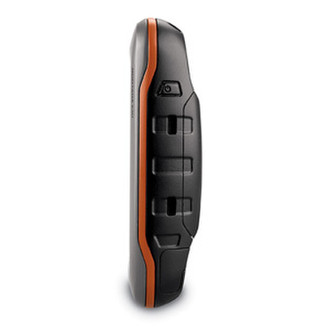
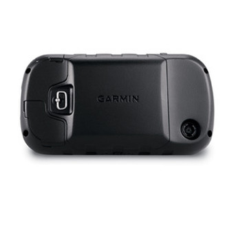
Now there’s one handheld GPS for three very different activities; on foot, on wheels and on water, the new Montana 650 from Garmin will guide you wherever you go.. With a vast 4” sunlight-readable touchscreen that offers crystal clear enhanced colours, dual orientation display and high sensitivity HotFix® positioning to track your location, it’s easy to see where you are at all times. Both durable and waterproof, Montana 650 is built to withstand the elements.
<b>Navigate with Ease</b>
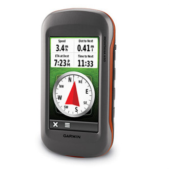
The Montana has key features for the outdoors such as a 3-axis tilt-compensated compass which shows your heading even when you’re standing still, without holding it level. It also has a barometric altimeter which tracks changes in pressure to pinpoint your precise altitude, and you can even use it to plot barometric pressure over time, which can help you keep an eye on changing weather conditions.
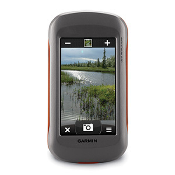
<b>Take Geotagged pictures</b>
Capture locations and memories with Montana 650’s 5-megapixel digital camera. Each photo is automatically geotagged with the location of where it was taken, allowing you to navigate back to that exact spot in the future. To keep track of your photos and show their location on a map, simply connect Montana 650 via USB and use Garmin’s free BaseCamp™ software.
<b>Go Anywhere</b>
With an array of compatible mounts, Montana 650 is designed for use on boats, as a handheld, off-roading or in your car. Use the auto mount with City Navigator NT® or Garmin GB Discoverer™ maps for spoken, turn-by-turn driving directions. Wherever you think you might take Montana, it has the mapping and mounts to get you there.
<b>Go everywhere</b>
Mapping options include the City Navigator maps for use in the car, BlueChart® g2 preloaded cards for a great day on the water, Garmin GB Discoverer™ which provides Ordnance Survey mapping on your handheld and BirdsEye™ Select that lets you download customised sections of premium raster-based maps to your device and integrate them with your maps. Montana is also compatible with Custom Maps which transforms paper and electronic maps into downloadable maps for your device.
<b>Share Wirelessly</b>
With Montana 650 you can share your waypoints, tracks, routes and geocaches wirelessly with other compatible Garmin GPS users. So now your friends can also enjoy your favourite hike or cache – simply press “Send” to transfer your information to other units.
<b>Keep in charge</b>
Montana 650 features a one-of-a-kind dual battery system. You’ll have the option of using the rechargeable lithium-ion pack or traditional AA alkaline batteries – whichever suits you best.
<b>Try Geocaching</b>
Montana 650 supports geocaching GPX files to download geocaches and details straight to your unit. Visit OpenCaching.com to start your geocaching adventure. Montana 650 stores and displays key information, such as location, terrain, difficulty, hints and descriptions, which means no more manually entering coordinates and paper print outs! Simply upload the GPX file to your unit and start hunting for caches.