Other features
| Storage capacity |
2048 MB |
| Basemap |
Y |
| Interface |
USB |
| Internal memory |
128 MB |
Display
| Display size (HxV) (imperial) |
4.8 " |
GPS type
| Auto |
Y |
| Motorcycle |
Y |
| Sport (fitness, running) |
N |
| Outdoor (hiking, trekking) |
N |
| Marine (chartplotters, sounders) |
N |
| Geocaching (GPS stash hunt) |
N |
| Aviation |
N |
| Bicycle |
Y |
Traffic Assist 7928 Europe
POINTS OF INTEREST
The map data for Europe contains special destinations including airports, hospitals, service stations, hotels, restaurants and stadiums. Miniature icons show points of interest along the selected route.
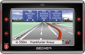
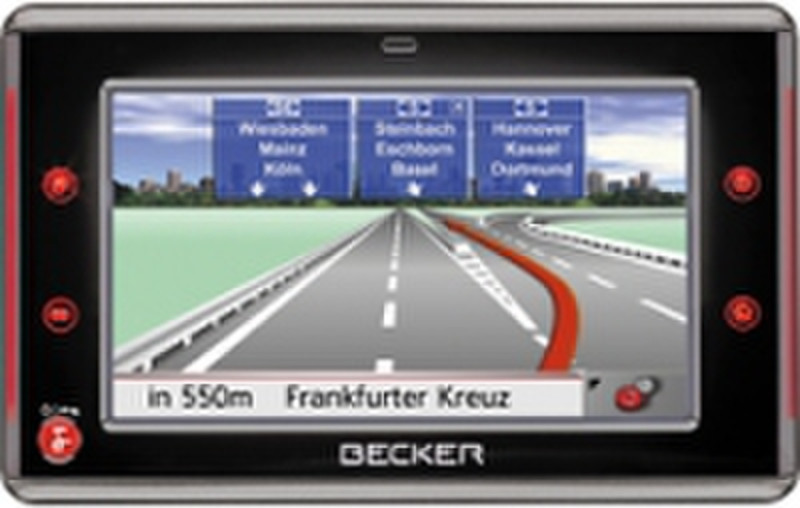
REALITY VIEW
Nearly 4,000 directional signs on European motorways are presented true to life on the high-resolution display. This provides a clear overview and alerts the driver ahead of time to upcoming lane changes and motorway junctions.
GPS NAVIGATION
The Global Positioning System (GPS) is a satellite-based navigation system developed by the United States Department of Defence. GPS signals accurately determine the position of a receiver within a few metres. Independent of the means of transport, the signal information is continuously scanned to precisely calculate routes and arrival times.
MOBILE NAVIGATION
Mobile navigation units are easy to install in just a few steps and can be used practically anywhere. A perfect travel companion for added safety and convenience in the car, on a bike or motorcycle.
TOUCH SCREEN
All menu items are quick and easy to access via the 4-inch touch-screen display.
MP3 PLAYER
Listen to music via the integrated MP3 player and two internal speakers or headphones without interrupting navigation. The display shows ID3 tags (title, artist), elapsed track time and directories.
PICTURE VIEWER
The Picture Viewer feature presents JPG images separately or in a slide show on the brilliant low-reflection, high contrast 4-inch touch-screen display with 16-bit density and 65,536 colours.
SD CARD
The 2 GB SD card that stores pre-selected maps and points of interest can also be used for music and image files. New data can be easily transferred to SD card via the USB interface.
TMC
With TMC (Traffic Message Channel), the latest traffic information can be accessed in the selected broadcasting area at any time. The navigation unit automatically detects the current traffic situation and recalculates the route on request. Dynamic route guidance helps avoid unnecessary delays.
DAY/NIGHT MODE
The display brightness can be easily adjusted from day to night mode via the "Settings" menu. This feature ensures optimal readability in changing light conditions, for example, when driving through a long tunnel.
SPEED LIMITS
A graphic image of the current speed limit appears in the display. An acoustic signal warns the driver when the preset level has been exceeded.
LANE INFO
The Lane Info function points the way on multi-lane roads and complicated motorway exits. This gives the driver enough time to change lanes as required.
3-D LANDMARKS
3-D landmarks enhance spatial orientation on the road. Buildings and other characteristic landmarks along the route are shown in three-dimensional views.