Power
| Number of batteries supported |
2 |
| Battery type |
AA |
| Battery life (max) |
16 h |
Memory
| Internal storage capacity |
4 GB |
Navigation
| Live Traffic Message Channel (TMC) |
N |
| Live service |
N |
| Routes quantity |
200 |
| Tracks quantity |
200 |
| Traffic Message Channel (TMC) |
N |
Technical details
| Tide tables |
Y |
| Area calculation |
Y |
| Sun & moon information |
Y |
| Waypoints |
Y |
GPS type
| Outdoor (hiking, trekking) |
Y |
| Geocaching (GPS stash hunt) |
Y |
| Sport (fitness, running) |
Y |
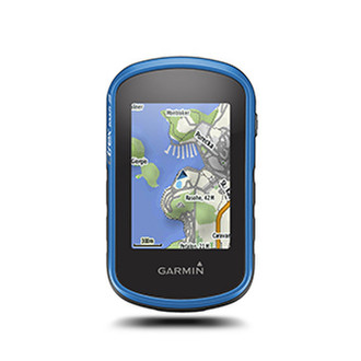
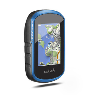
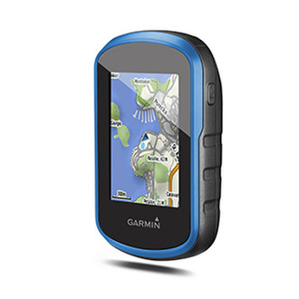
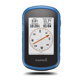
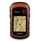
eTrex Touch 25, 6.604 cm (2.6 ") TFT, 160 x 240, 4 GB, microSD, 2 x AA, USB
<b>Color Touchscreen GPS/GLONASS Handheld with 3-axis Compass</b>
- 2.6-inch color capacitive touchscreen
- 3-axis tilt-compensated compass
- GPS and GLONASS satellites for faster positioning
- 250,000 preloaded geocaches from Geocaching.com
- 4 GB memory to hold more maps
Compact rugged and reliable GPS/GLONASS handheld with color touchscreen, featuring a 3-axis tilt compensated electronic compass, wireless connectivity, preloaded geocaches and expanded internal memory to hold more maps.
<b>See the Way</b>
eTrex Touch 25 features a sunlight readable, 2.6-inch color touchscreen display offering intuitive access to worldwide basemap with shaded relief. Durable and waterproof, eTrex Touch 25 is built to keep delivering vital mapping and tracking data no matter what the elements throw at you, standing strong against dust, dirt, humidity and water.
<b>New Tools for Your Trek</b>
eTrex Touch 25 features a built-in 3-axis tilt-compensated electronic compass that shows your heading even when you’re standing still, and you don’t have to hold it level to get an easy-to-understand display of your heading.
<b>Go Anywhere</b>
With an array of compatible mounts, eTrex Touch 25 is designed for use on ATVs, bicycles, boats, as a handheld or in your car. Wherever you think you might take eTrex, it has the mapping and mounts to get you there.
<b>Go Global</b>
eTrex Touch 25 can track both GPS and GLONASS satellites simultaneously. Developed by the Russian Federation, GLONASS satellites “lock on” to a position (on average) faster than GPS receivers. Using both GPS and GLONASS means the receiver has the ability to lock on to 24 more satellites than using GPS alone.
<b>Add Maps</b>
With its microSD™ card slot and a full 4 GB of internal memory, eTrex Touch 25 lets you load TOPO maps and hit the trail, plug in BlueChart® g2 preloaded cards for a great day on the water or City Navigator® NT map data for turn-by-turn routing on roads. eTrex Touch 25 also supports BirdsEye Satellite Imagery (subscription required) that lets you download satellite images to your device and integrate them with your maps.
<b>Find Fun</b>
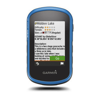
eTrex Touch 25 is preloaded with 250,000 geocaches from Geocaching.com. By going paperless, you're not only helping the environment but also improving efficiency. eTrex Touch 25 stores and displays key information, including location, terrain, difficulty, hints and descriptions, which means no more manually entering coordinates and paper printouts. Simply upload the GPX file to your unit and start hunting for geocaches.
<b>Plan Your Next Trip</b>
Take charge of your next adventure with BaseCamp™, software that lets you view and organize maps, waypoints, routes and tracks. This free trip-planning software even allows you to create Garmin Adventures that you can share with friends, family or fellow explorers. BaseCamp displays topographic map data in 2-D or 3-D on your computer screen, including contour lines and elevation profiles. It also can transfer an unlimited amount of satellite images to your device when paired with a BirdsEye Satellite Imagery subscription.