Technical details
| Waypoints |
Y |
| Sun & moon information |
Y |
| Area calculation |
Y |
| Tide tables |
Y |
| Unit-to-unit transfer |
Y |
| Tracklog |
Y |
| Image viewer |
Y |
| Hunt/fish calendar |
Y |
Navigation
| Routes quantity |
200 |
| Barometric altimeter |
Y |
| Electronic compass |
Y |
| Traffic Message Channel (TMC) |
N |
| Automatic routing |
Y |
| Navigation protocols |
NMEA 0183 |
| Photo navigation |
Y |
| Live service |
N |
Display
| Display diagonal |
3 " |
| Display size (HxV) (imperial) |
2.5 x 1.5 " |
| Widescreen |
N |
| Touch screen |
Y |
| Display |
TFT |
GPS type
| Auto |
N |
| Sport (fitness, running) |
N |
| Outdoor (hiking, trekking) |
Y |
| Marine (chartplotters, sounders) |
N |
| Geocaching (GPS stash hunt) |
Y |
| Aviation |
N |
| Truck |
N |
| Golf |
N |
| Camper/Caravan |
N |
Map
| Ability to add maps |
Y |
| Maps included |
N |
| Map coverage |
N |
Power
| Battery technology |
Lithium |
| Battery type |
AA |
| Battery life (max) |
16 h |
| Power source type |
Battery |
| Number of batteries supported |
2 |
Weight & dimensions
| Depth |
33 mm |
| Width |
61 mm |
| Weight |
209.8 g |
| Height |
114 mm |
Design
| Water-resistant |
Y |
| Form factor |
Handheld |
Memory
| Internal storage capacity |
1.5 GB |
Radio
| Supported radio bands |
Not supported |
Additionally
| Colour of product |
Black, Grey, Orange |
| Number of Waypoints |
4000 |
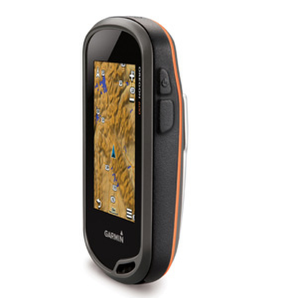
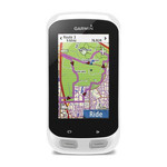
7.62 cm (3 ") TFT 240 x 400 pixels, 1.5 GB, microSD, Flashlight, IPX7, 2 x AA, USB & NMEA 0183, 209.8 g
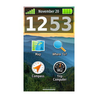
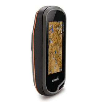
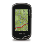
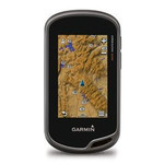
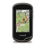
With high-sensitivity GPS and GLONASS satellite tracking, worldwide basemap with shaded relief and customizable buttons for 1-touch waypoint marking, Oregon 600 opens a new world of GPS mapping and positioning.
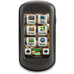
Touch and Go
Oregon 600 has reflective display technology for the most brilliant, sunlight readable touchscreen we’ve ever made. The screen is strengthened for impact resistance, with multi-touch and dual orientation views that accommodate gloved operation.
Double Your Power
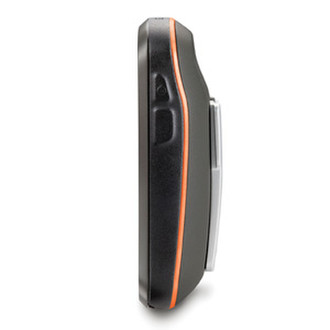
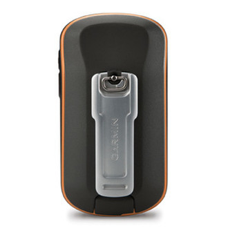
Oregon 600 features our state-of-the-art dual battery system. Use the optional rechargeable NiMH pack (not included) or traditional AA batteries — NiMH pack charges when the device is connected to external power.
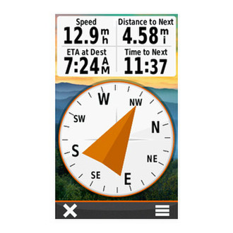
Get Your Bearings
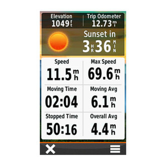
Oregon 600 has a built-in 3-axis electronic compass with accelerometer tilt compensation to show where you're heading even when standing still, or not holding it level. Its barometric altimeter tracks changes in pressure to pinpoint your precise altitude. You can even use it to plot barometric pressure over time to keep an eye on changing weather conditions.
With its high-sensitivity, WAAS- and GLONASS-enabled GPS receiver and HotFix® satellite prediction, Oregon 600 locates your position quickly and precisely, and maintains its GPS location even in heavy cover and deep canyons.
Share Wirelessly
With Oregon 600 you can share your waypoints, tracks, routes and geocaches up to 50 times faster with other wireless compatible Garmin handheld devices. Plus, you can share large files too like photos, Garmin Adventures and Custom Maps. Just touch “send” to transfer your information.
Add Maps
Adding more maps to Oregon is easy. Load TOPO U.S. 24K maps and hit the trail; add Trailhead Series TOPO maps and explore famous treks like the Appalachian Trail and the Pacific Crest Trail; plug in BlueChart® g2 preloaded cards for a great day on the water; or load City Navigator® map data for turn-by-turn routing on roads. Add satellite images to your maps with BirdsEye Satellite Imagery (subscription required).
Load All the Geocaches
No more picking, choosing and planning, just download them all. Oregon 600 can hold up to 4 million. Download every cache on OpenCaching.com. Load caches from GSAK. Or use your favorite program or website supporting GGZ files. All your paperless geocaching features will be there for every cache. Read full descriptions, hints and logs. View cache photos. Filter caches by size, terrain, difficulty and type. Connect to chirp-enabled caches. Record your logs in the field. Do it all.
Plan Your Next Trip
Take charge of your next adventure with BaseCamp™, software that lets you view and organize maps, waypoints, routes and tracks. This free trip-planning software even allows you to create Garmin Adventures that you can share with friends, family or fellow explorers. BaseCamp displays topographic map data in 2-D or 3-D on your computer screen, including contour lines and elevation profiles. It also can transfer an unlimited amount of satellite images to your device when paired with a BirdsEye Satellite Imagery subscription.