Power
| Number of batteries supported |
2 |
| Battery type |
AA |
| Battery life (max) |
16 h |
Memory
| Included memory card size |
2 GB |
| Storage media type |
Flash |
Camera
| Built-in camera |
Y |
| Megapixel |
3.2 MP |
Other features
| Antenna type |
Multidirectional Patch |
Technical details
| Built-in microphone |
Y |
| Image viewer |
Y |
| Sun & moon information |
Y |
| Calculator |
Y |
| Waypoints |
Y |
Processor
| Processor frequency |
400 MHz |
Map
| Map view options |
2D |
| Maps included |
Y |
GPS Performance
| GPS accuracy - position |
5 m |
| Antenna |
Y |
Navigation
| Tracks quantity |
1 |
| Traffic Message Channel (TMC) |
N |
GPS type
| Geocaching (GPS stash hunt) |
Y |
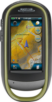
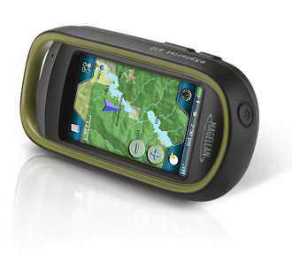
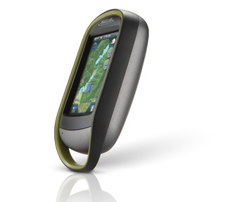
eXplorist 610, 3.2MP, 195g, 7.62 cm (3.0 ") , Touch Screen, microSD
Rugged and waterproof (IPX-7), the eXplorist 610 combines high sensitivity GPS reception with easy to read mapping and accurate navigation. Find your way using more than 30 navigational data fields. Create waypoints, record tracks, and route from point to point. The integrated 3.2 mega-pixel camera, microphone, and speaker enable outdoor enthusiasts to record geo-referenced images and voice notes. Relive your outdoor adventures on the device, on your computer, or share with others on various online communities like geocaching.com.
Enjoy paperless geocaching with the eXplorist 610. Download and view more than 20 unique characteristics of each cache and view, search, filter on the device. Details include name, location, description, hider, size, difficulty, terrain, hint, and recent logs created by other geocachers.
The eXplorist 610 packs the most accurate maps into the palm of your hand. The World Edition map allows for 2D or 3D viewing angles. It includes a complete road network in United States, Canada, Western Europe, and Australia and major roads throughout the rest of the world and provides cartographic orientation in almost any location. This unique, preloaded map also includes water features, urban and rural land use, and a realistic shaded relief background. The eXplorist 610 also includes Summit Series USA, a highly detailed topographic map based on 1:24,000 scale source maps. The maps includes contour lines, land use areas, trails, waterway7s and points of interest. Locate the nearest trailhead. Search for the nearest bike shops, fuel stations, or potable water source. Navigate safely in 3D perspective view while knowing the boundaries between private and public lands.