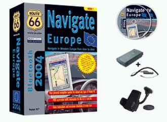
Route 66 Navigate Europe 2004 (Bluetooth)
Navigate in Britain and Western Europe from door to door
Your personal navigation system for almost any type of Pocket PC
Voice instructions and on-screen directions at every turn
Navigate across Western Europe using only one single map
Add your personal Outlook contacts as waypoints to your route
Night colours
Avoid toll roads, ferries and motorways
Geographic coverage: Western Europe - Street Network
Professional geographic data from leading in-car navigation manufacturers
More than 2,700,000 miles of road
More than 54,000,000 house numbers
More than 700,000 points-of-interest
Multi-lingual user interface
FREE up-to-date traffic information whilst on the road for GB, D, F, I and NL via a wireless internet connection
ROUTE 66 Navigate Europe 2004 transforms your Pocket PC all at a sudden into a powerful navigation system up to house number accuracy! If your Pocket PC is connected to a GPS receiver, turn-by-turn voice instructions guide you to your destination. You can add any number of intermediate waypoints to your route that you may have selected from your personal Outlook contacts as well. If you miss a turn, then ROUTE 66 Navigate Europe 2004 immediately recalculates your route. User-defined maps of arbitrary size help you to save the precious memory of your Pocket PC. Furthermore, with a wireless Internet connection you stay informed about the current traffic situation in Britain, Germany, France, Italy and the Netherlands, even when you are on the road! In addition to all this, you can navigate to any of the many points-of-interest like hotels, restaurants and petrol stations. In summary, ROUTE 66 Navigate Europe 2004 is an absolute must for those drivers who do not like to consult a paper map ever again!