System requirements
| Minimum RAM |
1024 MB |
| Minimum processor |
Intel, PowerPC G4 |
Software
| Mac operating systems supported |
Y |
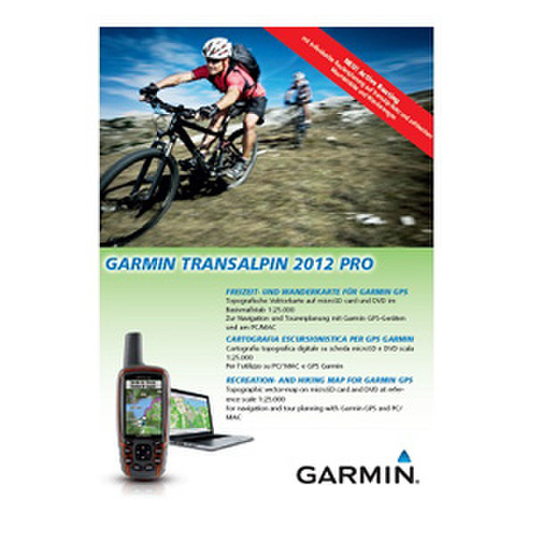
TransAlpin 2012 Pro, DVD/MicroSD, aera/eTrex Legend/Edge
Always find the right tracks for your alpine adventure in Austria, Germany, Italy, Switzerland, Slovenia and Lichtenstein. The ultimate map for outdoor recreation, Garmin TransAlpine includes hiking/mountain biking trails, mountain peaks and crossings as well as searchable points of interest.
- Shows high quality digital topographic vector map data (1:25.000) in parts of Austria, Italy, Germany, Switzerland and Slovenia.
- Includes Digital Elevation Model (DEM) and dense contour intervals of 20 m isobar distances.
- Displays special routes or information depending on the activity chosen, differentiating between pedestrian activity and cycling activity.
- Includes searchable business, touristic, outdoor and recreational points of interest as well as geographic places, mountain ranges, city points and street names.
- Includes integration of basic road network attributes for secure routing for cyclists on the road network.
- Offers ActiveRouting¹, allowing you to customize and specifically plan routes for the entire road and trail network. The activity-specific map displays highlights of suggested routes in addition to dedicated biking and hiking routes.
- Shows dense coverage areas, including mountain tops, mountain shelters and cable cars.
- Includes BaseCamp™ software for managing data on your GPS and computer, playing back routes and tracks, geotagging photos and more.